Evergreen Audubon began the Bear Creek Watershed Breeding Bird Atlas (BBA) in 2008, and like other BBA’s that are conducted world-wide we are engaged in an attempt to provide information on the distribution, abundance, habitat preference, and breeding success of birds in a specific region.
Currently in its ninth year, Evergreen Audubon’s BBA focuses on the local breeding bird community throughout the Bear Creek Watershed – from Mount Evans to the South Platte River. Within that vast area we have focused on 45 parcels of public land where we look for any signs of breeding: from singing males setting up territories, to courtship behavior, to nest building, to finding recently fledged youngsters. This article is to help you gain familiarity with our atlas website, and to walk you through a few fun pages of the website related to our progress thus far.
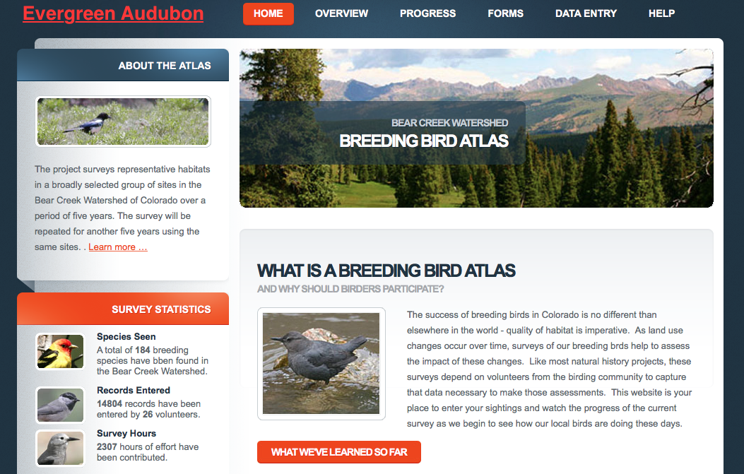
When you open the website http://www.bcwbba.org, here is what the Homepage looks like, and if you click on the Progress tab at the top you will be taken to the initial Progress page (see below).
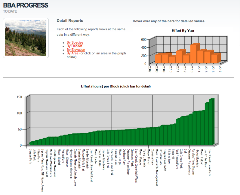
This initial Progress page summarizes the amount of time that has been expended in the 45 different public lands, and how much time overall has been spent in the field on a yearly basis. You can see that some areas have received far more attention than others (Bear Creek Lake Park with over 140 hours, and Bergen Park with less than 8). This discrepancy is due to our small pool of volunteers, the individual enthusiasm with which some folks embrace this project, the amount of time they can afford to spend in the field, and the emphasis that we choose to place on some locations and habitats over others.
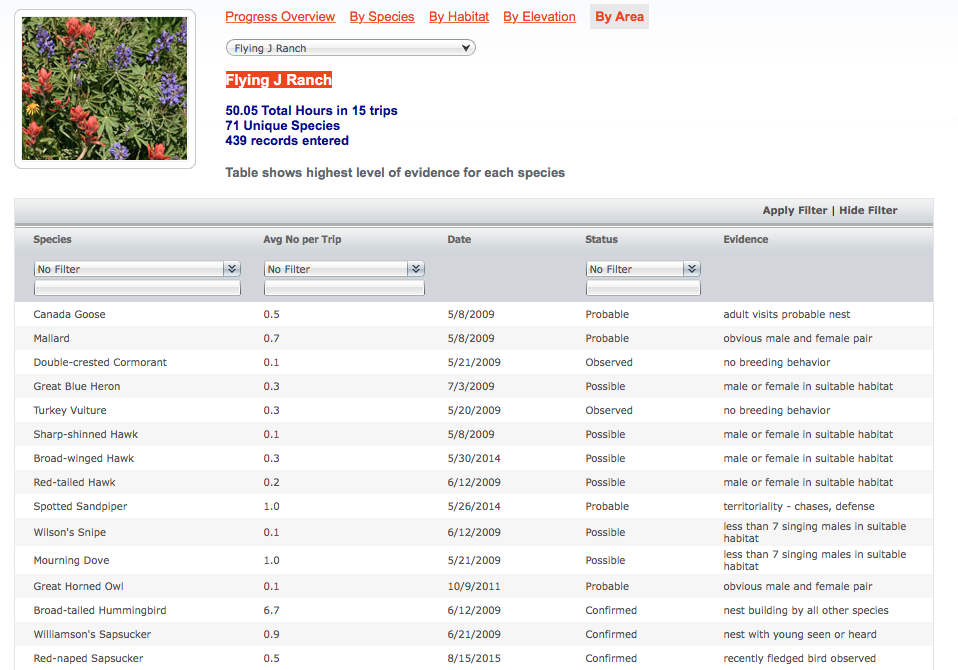
From this screen you can then click on one of the green bars in the bar graph in order to learn more about a specific area. For example, here’s a portion of the screen that comes up for Flying J Ranch telling you that 71 species have been recorded, and that we’ve been able to confirm breeding there for Broad-tailed Hummingbird (nest building) Williamson’s Sapsucker (nest with young), and Red-naped Sapsucker (fledgling). If you were then to scroll through all 71 species, you would see that thus far we have been able to confirm breeding at Flying J for 29 species.
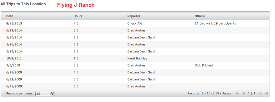
By scrolling to the bottom of that page you can also see who has entered data for Flying J and the date that they were there.
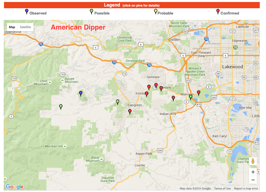
One of the more interesting aspects of the “Summary” pages is found by going to “Summary by Species.” There, you can bring up maps for each species known, or suspected, to breed in the watershed. For example, here’s the map for American Dipper. The red makers indicate where we have confirmed Dipper breeding, and you can click on any of the markers for additional information related to that sighting. No surprise that the red markers are primarily along Bear Creek, with one on Cub Creek. And, though there have been additional sightings along Upper Bear Creek, nothing thus far indicates breeding that far up the valley.
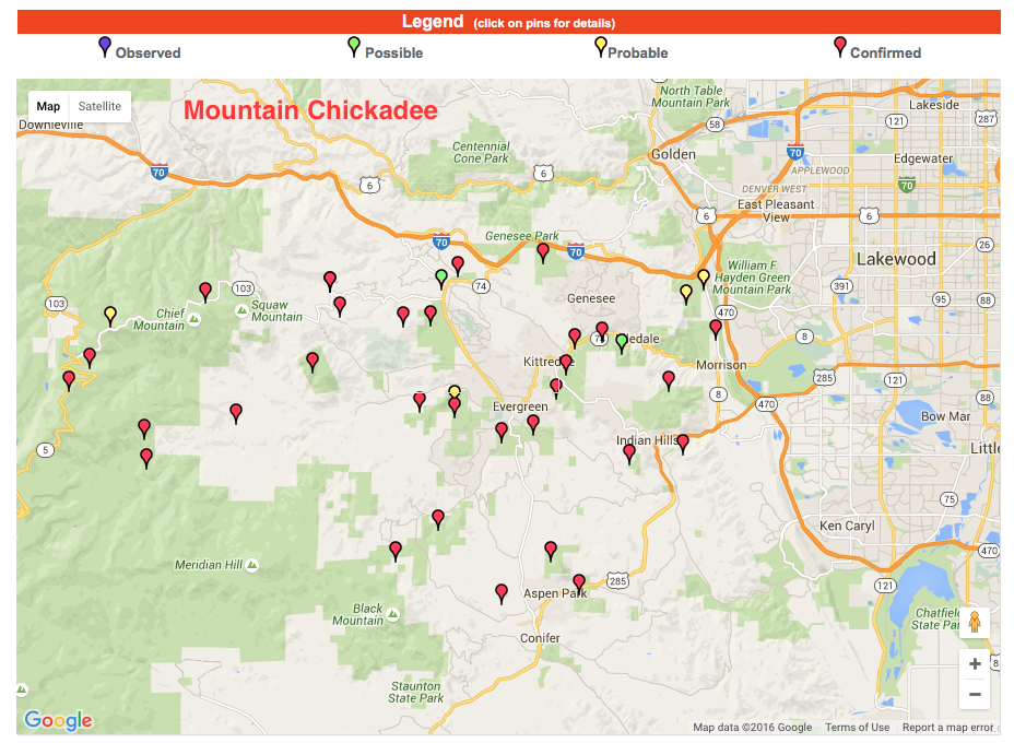
Here is the map for Mountain Chickadee, a species that we know well, and for which we have been able to document breeding throughout the watershed in various habitats from 6500 to 11,500 feet.
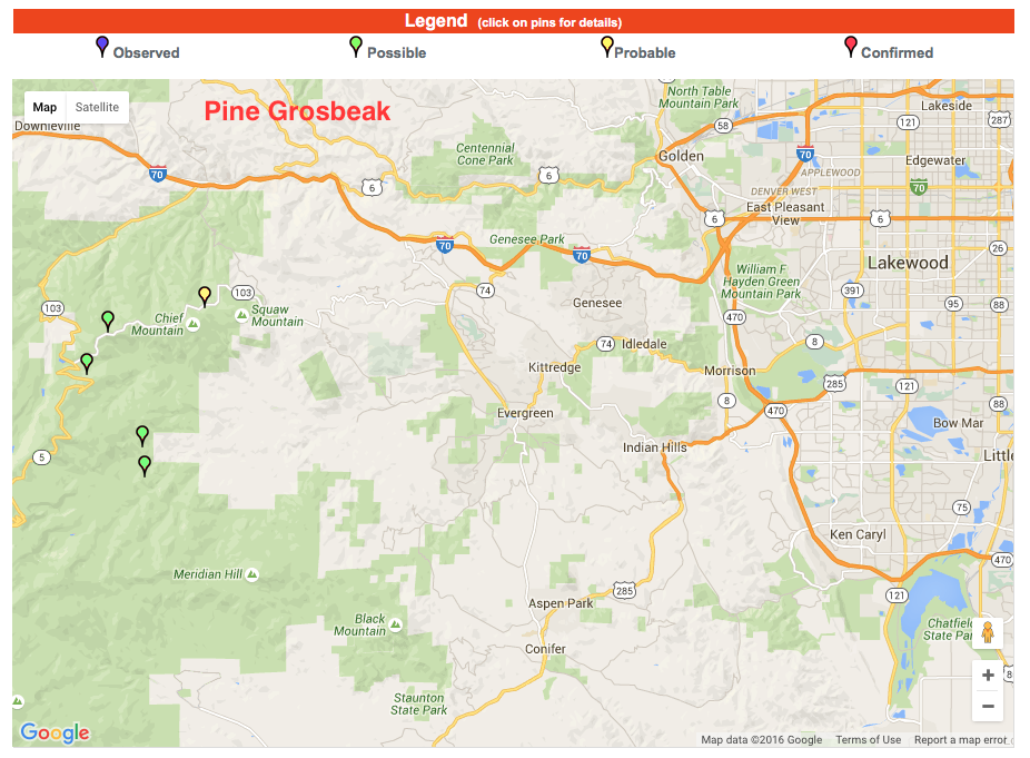
In contrast, here is the map for Pine Grosbeak. We have found them at higher elevations in Spruce-Fir Forest, but have yet to document breeding, again largely a factor of our limited volunteer pool.
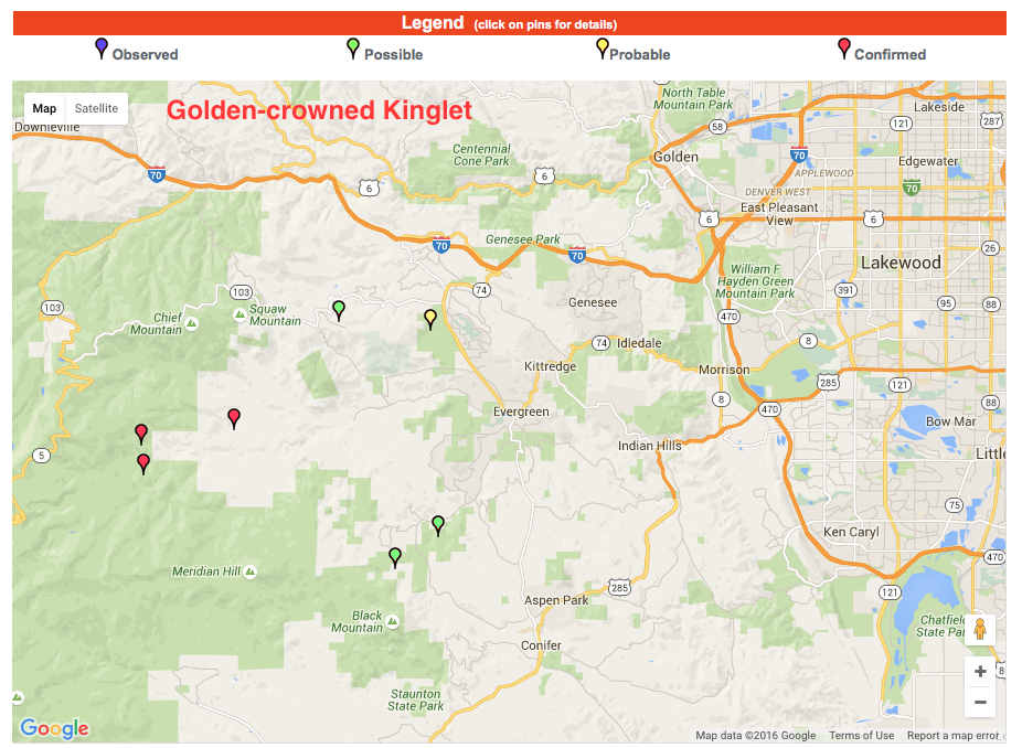
Here’s another one of our high elevation species, Golden-crowned Kinglet. We do see them occasionally at mid elevations, but when it comes to breeding they prefer dense Spruce-Fir Forest. The three confirmations below are from Beaver Meadows, Beartrack Lakes Trail, and the Elk Management Area. Again, when you are actually on the website you can click on the various markers to obtain this specific location information.
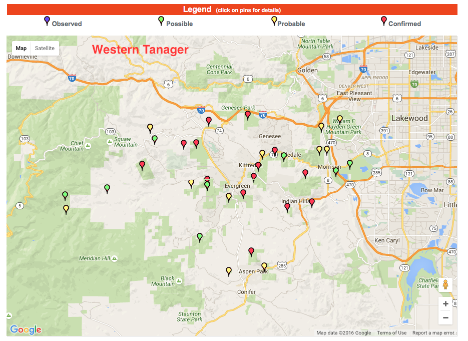
Next is our map for Western Tanager. While they have been recorded in the edge of the foothills and up in the Elk Management Area, our map confirms that they prefer to breed in the foothills and lower mountains, with a preference for Ponderosa Pine Forest.
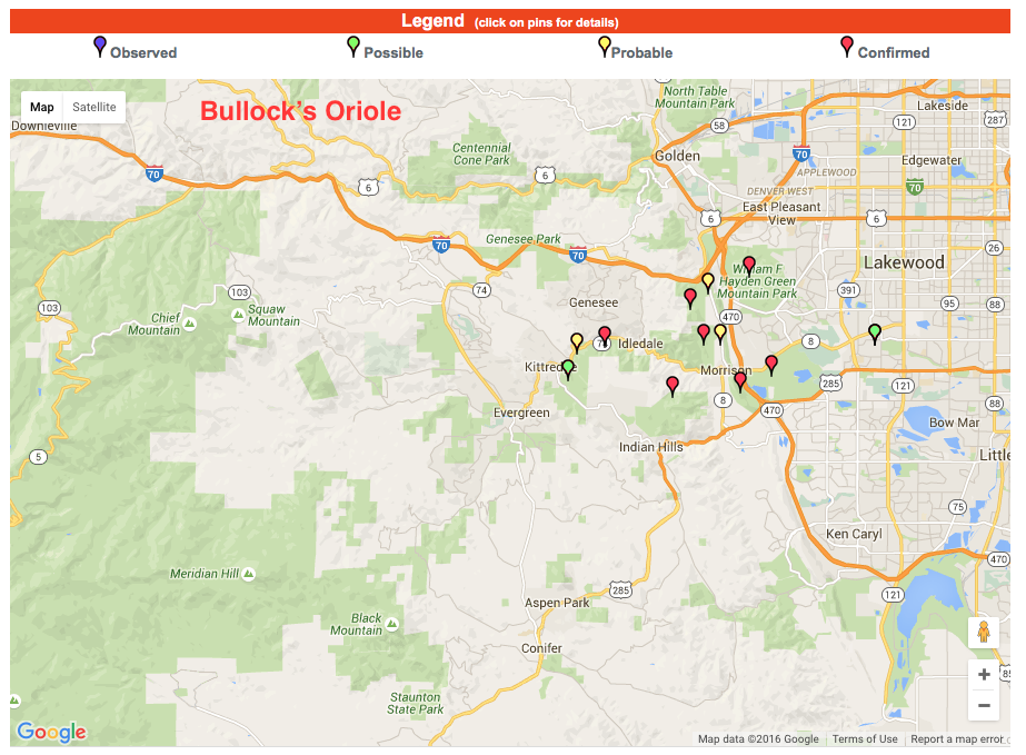
Finally, here is our map for Bullock’s Oriole, which breeds in riparian forests of the plains and lower foothills. Our farthest west confirmation on the map below is from Lair O’ the Bear.
I encourage everyone to visit our Breeding Bird Atlas website and enjoy more of these maps. While there you can also find out more about what a breeding bird atlas is, and learn how we go about our business in the field.
Comments
Write Comment